

The U.S. Census Bureau has created a set of maps showing the most and least vulnerable parts of Puerto Rico. They’ve decided this by measuring the level of social vulnerability residents have.
What’s social vulnerability?
The characteristics being considered:
- poverty status
- number of caregivers in the households
- unit-level crowding
- educational attainment
- employment
- disability status
- health insurance coverage
- age (65+)
- vehicle access
- broadband internet access
So a household living above the poverty level, with two caregivers, no crowding in the home, educated residents under 65 who have jobs and no disabilities, with health insurance, a vehicle, and broadband access — that household would have zero vulnerabilities. Their neighbors, an elderly couple with a comfortable income, a vehicle, broadband internet, and insurance, would have one or two vulnerabilities. Down the street, the single mom with an elderly, disabled parent living in the home would have three or more.
The maps
First, here’s a map showing in darker green the parts of the territory where people have no vulnerable characteristics:
As you can see, San Juan and Bayamon and the areas around them have the largest proportion of residents who do not have any of the measured vulnerabilities.
Next, a map measuring the residents with one or two vulnerabilities:
In the darkest purple sections, such as Penuelas, 46% or more of the people have one or two.
Finally, the third map shows the areas where people have three or more of the vulnerable characteristics:
In the darkest orange areas, such as Las Marias and Guanica, 53% or more of the residents have at least three. These people have a high level of social vulnerability.
What’s the message?
The Census Bureau figures that households with multiple vulnerabilities will be less resilient than those with fewer. If people have more of the characteristics that make life more difficult, they will be less able to ride out tough situations. This includes natural disasters, pandemics, and other kinds of emergencies.
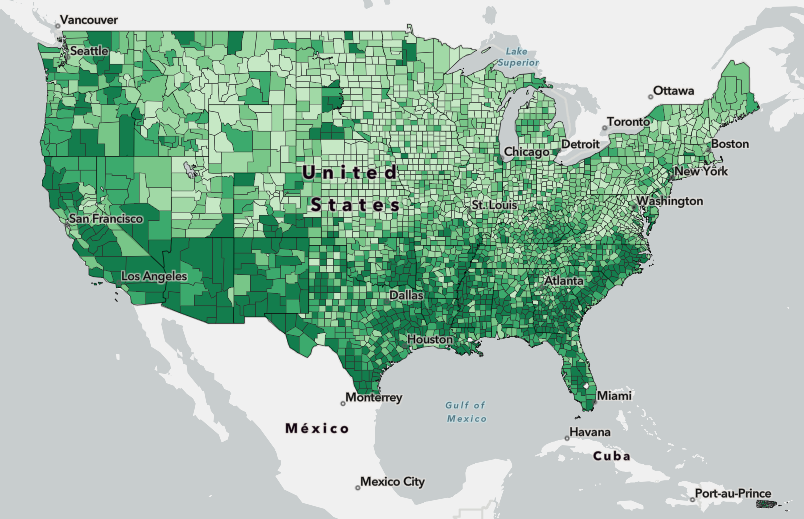
For Puerto Rico overall, the level of vulnerability runs about double what it is in the states. Most states have some residents with high levels of social vulnerability, but the average is about twice as high in Puerto Rico.
This information is intended to help governments and charitable organizations figure out what kinds of resources they need in a given place in order to respond effectively to disasters and other special situations. FEMA uses these maps to plan effective responses. The Centers for Disease Control use the data to determine whether areas have sufficient access to healthcare. Policy makers use the information to make decisions about ways to help increase resilience.
For Puerto Rico, this information could suggest that FEMA should reduce red tape to make it easier for the vulnerable areas to have access to needed help. The Natural Hazards Center suggested that increased community support, local decision-making, and awareness of inequality among communities could help mitigate the destruction in future disasters.


No responses yet